Monday, December 21, 2009

Elba Pass: First Snowshoe Outing of the Season

December 19, 2009


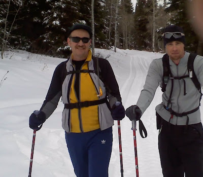
I went with a great friend, Justin Mitchell, and his biking friend, Stan Baker to Elba Pass. There is a dirt road here that connects Oakley and Elba. I had never been on this road before. From what the guys says, it is terrible in the summer. The road was snow covered most of the way. It got progressively deeper as we pushed for the top of the pass. We decided to park 400 yards or so from the top. We donned our snowshoes and got after it.


Here is a shot of Justin by the truck before we left. On my phone, the splint he has on his finger looked like a cigarette in his fingers. Doesnt look that way here, but he is still one bad mutha!!


Blurry Picture here of me. This is the point when I was gassed (after almost an hour of going at a good pace)......maybe fitting that the picture is blurry...kinda like my eyes felt fot a minute there. Guess who rescued me AGAIN?? Swedish fish!!!!!!!!

Loved this shot: Me, Stan and Justin. Stan is 60 years old. I really hope I can be at his fitness level when I reach 60. The man is a machine!! Move over young bucks (thats me, of course!!) At one point, I asked Stan where he was with his heart rate and he siad 172 (heart rate monitor). He held it there for a while! Awesome!


Stan and Justin heading back down trail we broke earlier.


This picture makes it look like we were in fresh powder. Not! We had to WORK to break throught this crusty snow!


Good thing my finger is in almost everyone of these pictures. Argghhhhh


Dont mess with this guy!!


Loved this picture of Stan: Our GPS navigator guy for the day


I believe this is the west side of Mt Independence


Thanks Stan and Justin for pushing me on this day!! It was a perfect day........No wind, a little sunny, not cold. In fact, I was overheating with just a fleece jacket on. We didnt make it to Indepedence Lakes, but this was just as fun and satisfying!!


Thursday, October 29, 2009

BYU vs TCU Game

Courtney and I went to the BYU/TCU game on October 24, 2009. I was very excited for the game. Honestly, I thought the outcome would be a little better........I wasnt expecting a blowout. TCU outplayed BYU in every facet of the game! Dang! It was still a fun time!


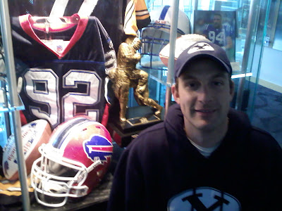
Before the game, we went to Legacy Hall in the new Student Athlete Building on campus. I liked this Heisman display for Ty Detmer
Pregame snap of the Cougar outside of Lavell Edward Stadium.

Close up of Ty's prize.


Standing by Ryan Denney's jersey on display. He and I were mission companions in Buenos Aires, Argentina. He is a big guy.......6'7"...............lets just say I always felt safe out in the streets with Ryan.

The weather before and during the game was crazy. Dark clouds swirled all around us during the game. This is Provo Peak to the east.


Mt Timpanogos to the north.


Very cool atmosphere !!


Monday, October 19, 2009

Cache Peak, ID

I had a fun hike this last weekend, Friday, October 16, 2009. I climbed Cache Peak, located in Southern Idaho. It is the tallest peak south of the Snake River in Idaho, standing at 10,339 ft. I have wanted to climb this mountain for a long time. I decided to do a solo climb. Honestly, I was pretty apprehensive about going by myself........getting stuck, mountain lions, turning an ankle, etc. To my luck, everything turned out okay. It was a very nice fall day.....sunny as ever, hardly any breeze. I decided to take the southwest route, following the description given at http://www.idahosummits.com/cache/cache.htm . Most people try to climb Mt Independence on the same day as Cache. Due to time constraints, I decided to just do Cache. I plan to return to climb Independence....in fact, I would like to approach it via the Independence Lakes trail to the north.

Trailhead was easy to find. The roads getting to the trailhead were very muddy, due to melting snow. I almost got stuck in a giant puddle. I hiked up this rangers trail to start. Very nice trail.

It wasnt long before I was hiking in snow.
This is a good picture of saddle between Independence (left) and Cache (right).


Another view of Cache


I loved this part of the hike. This is peering down into one of Independence lakes.


Once I got to the saddle area, the snow got deeper. I was wishing I would have packed my snowshoes.


It was awesome to finally see the cairn on top.


Getting closer.


In plain view now!


View from the summit. You can just see the tip of Independence.


Loved this view. City of Rocks to the south.


Mt Harrison/ Pomerelle area to the North


Looking directly east.


Summit shot by the cairn.


I really enjoyed the hike. It wasnt hard at all. The trail head is at roughly 8400 ft. The elevation gain is just under 2000 ft. From car to car, it took a little over 3 hours round trip.
It wasnt the same going by myself. It is so much more fun to share something like this with other people!!


Tuesday, October 13, 2009

Ben Lomond- May 2009

I went on an awesome hike with Michael Monson, my old roommate from BYU, and his friend, Dave Fawcett. We hiked to the top of Ben Lomond Peak, UT. I have always had an admiration for this mountain. My parents both grew up in the Pleasant View/North Ogden area. During family reunions at the Barker Family Park, I remebering seeing BL and thinking how awesome it is. One summer, my Aunt Mary Ann used to take us to the top of the Pole Patch and we would ride out bikes back down to their home in PV. I remember seeing the gullies on the south side of the mountain and wondering what it be like to climb.

Mike, Dave, and I met at the Fred Meyer parking lot in Ogden and traveled up to the trailhead near North Ogden Park (I think that is what it is called). Very nice trail! The switchbacks at the beginning seem to take a while to traverse, especially coming down.


This first picture is at near 7200 ft. Looking south toward Big Pine resevoir.


Ogden Valley from the Summit

Summit Marker


Mike and Dave on the Summit


Willard Peak to the North


It was a wonderful trip. I treated myself to some Taco Time afterwards and then made the trek back to Rupert.


Monday, September 28, 2009

Toxaway/ Petite Lake Loop and Snowyside Peak

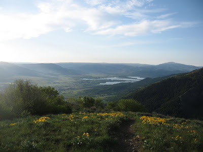
I wanted to share a few pictures of the trip that we took with our Ward Scout Troup to the Sawtooh mountain range in Idaho. We did the famous Toxaway/Petite Lake Loop. We left early Monday morning July 20, 2009. For the most part, the hike was pretty good. This area is surrounded by mountains, high alpine lakes, trees everywhere.....it is very beautiful.
This first picture is a summit shot of me on the top of Snowyside Peak
Here is a group picture of the troop on top of Snowyside.
Wooden cairn on the summit. Register was inside the box.


Alice Lake with the Sawtooths in the background. I thought this little area was the reason the range has the name "Sawtooths"


We found this water fall/ stream area above Toxaway Lake. Water running down the soild granite hillside was AWESOME!!


El Capitan and reflection on Alice Lake


Toxaway Lake with Snowyside Peak on the far left. Believe it or not, it is the highest of the 3 peaks here.


Some of the scouts above Toxaway Lake


This is a great place to hike, fish, climb, etc. There is so much wilderness in this area. The downer of the trip was dealing with the mosquitoes. They were EVERYWHERE!! I took my own personal can of repellant and ran out in 3 days. They say late August is a good time to go: low bug count and no snow! It was fun to be with scouts. WE must have pumped over 100 gallons of water over the course of 4 days. No problems with diarrhea or the likes.
Trip Stats:
Loop is a little over 18 miles.
Trailhead elevation: 6500 ft??
Snowyside elevation: 10651 ft
Hike could be done in a long day, or broken up into multiple-day trip. Between the streams and lakes, there were plenty of places to filter water. No fires are allowed on the trail.